
Northern Arizona
- dougsmith51
- May 2
- 8 min read
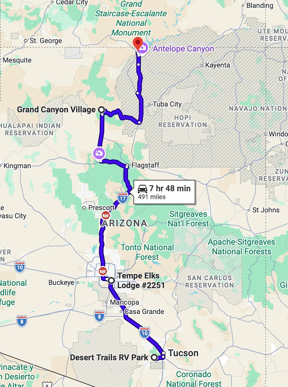
We left Tucson on Wednesday, April 15. Before departing town, we had the six tires on the Ciaowagen changed. RV tires tend to age out rather than wear out, with the rubber deteriorating from sun damage, and our tires were five years old. They also had 60,000 miles on them.
We headed north to the Phoenix area, about a two hour drive. We parked the RV at the Elks Lodge in Tempe (near Phoenix).
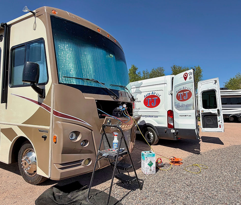
During the drive north from Tucson, we discovered that the dashboard air conditioning in the Ciaowagen was not working ("It's always something..."). Fortunately, the roof units we use to cool the inside while camped were fine. We thought we'd try to find somewhere to fix things in Tempe.
On Friday, April 17 we flew-then-drove to North Carolina's Outer Banks for our nephew's wedding. We rode to Sky Harbor airport in a driverless Waymo taxi - our first time! The ride was very smooth.

We landed in Raleigh, picked up a rental car, and then drove 3 hours east to the Outer Banks.
It was a bit of a shock to the system to move in a single day from the desert to the ocean. At least there is sand in both places!

The wedding was lovely, and a good chance for Jeannette to connect with two of her three siblings.

We returned to Tempe on Sunday, the 20th. The next day, a great mobile A/C repair service to come and fix the dashboard A/C. Cool driving again!
Sedona
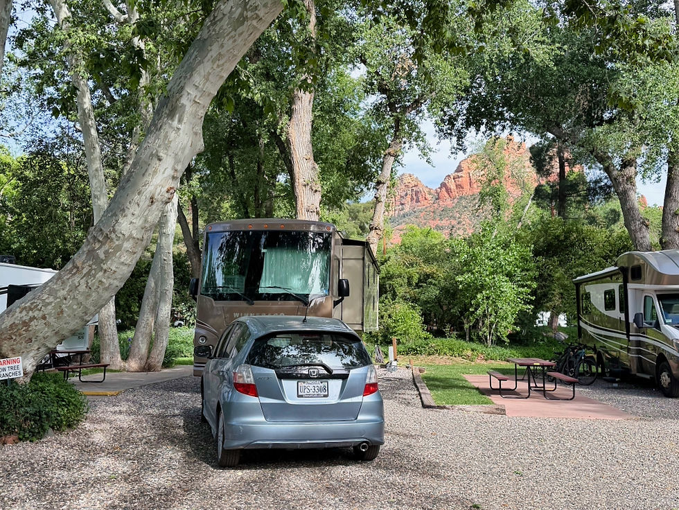
Next it was one to Sedona for two nights at a campground right near the center of town. It felt private, but was a convenient walk to shops and restaurants. One of the prime challenges was maneuvering around a big tree to get into our campsite.
As you may know, Sedona is a big "new age" spot with vortexes, crystals, and such.

It was a struggle, but we held ourselves back from having our auras photographed.
On our first night, we ate at a great seafood restaurant and had an amazing sunset view of the surrounding cliffs.

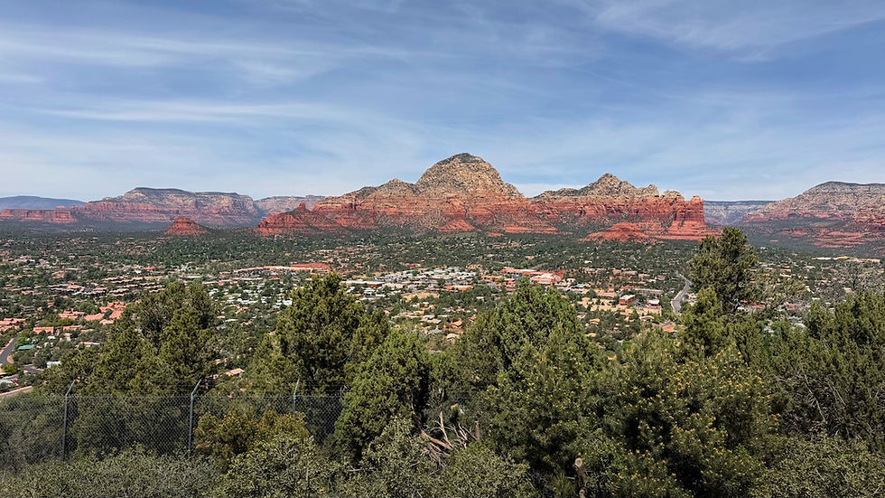
The next day we drove up to the airport for a great view of the town of Sedona.
On our last full day in Sedona, we were able to walk right from the campground to a very nice hike called Marg's Draw. Then it was on to . . .


The Grand Canyon

We had not been to the Grand Canyon since 2020 during COVID. We snagged a camping spot at the Trailer Village RV Park inside the national park on the South Rim. The North Rim, where a 2025 fire had burned down many of the park structures like the visitor center and hotel, would not reopen until sometime in May.
With cuts to the National Park Service budget, only three entrance booths were manned, meaning we had a 20 minutes wait to get into the park. On top of that, foreign visitors now pay a higher price for entry than U.S. citizens, meaning every single car had to show their identification.

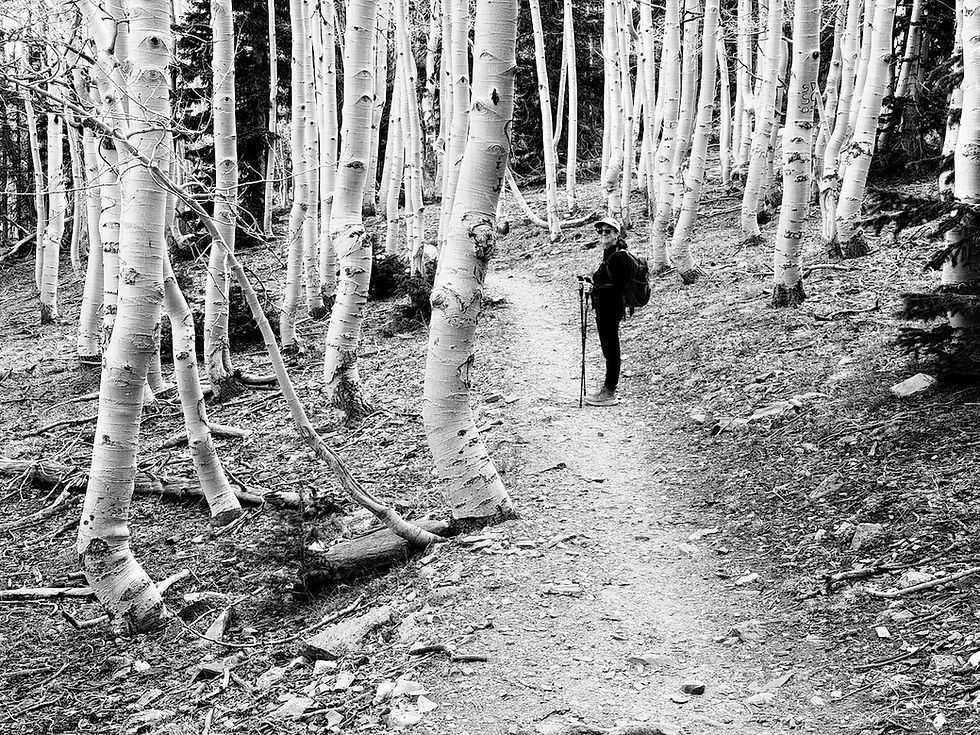
After we checked in at the campground, we decided to walk to the visitor center near the rim. Walking through this pine forest, who would suspect a 10-mile-wide chasm lies just ahead?

There are desert plants, like prickly pear cactus, but they are much smaller than their cousins down in Tucson. Also some beautiful wildflowers.


We also saw a number of birds, and the national park's elk herd hung out by the sides of the roads.

If you've ever been to the Canyon, you'll know that pictures cannot fully convey the experience of being there. Please find a small sample of what we saw in the gallery below (NOTE: you can click on each picture to expand it to full size).


The layers of the canyon reflect more than a billion years of earth's history. For part of that period, the area where the canyon now sits was a shallow sea, and you can see evidence of ancient shells embedded in the sandstone.

The National Park Service has a fairly extensive shuttle system to move people around, and we used that system rather than driving the Fittata.


The only exception was to get to Desert View and its iconic watchtower about 23 miles east of Grand Canyon Village. The western parts of the rim road can only be accessed via the shuttle system.
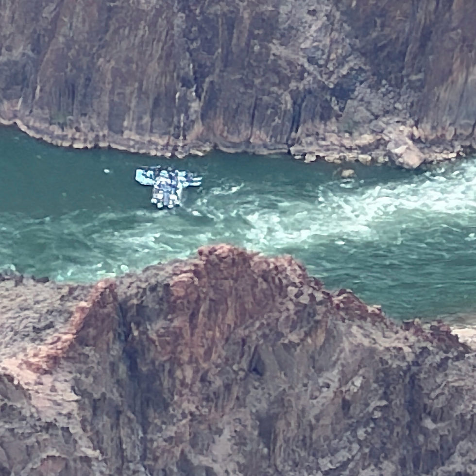
We had our binoculars with us and saw, in one of the sections of the Colorado River visible from the rim (there aren't many), some rafts of people who were taking a trip through the canyon.
The Canyon rim sits at 7,000 feet above sea level, so the temperatures were cool: 50s in the daytime and 30s at night. It was also mostly cloudy during our time there, with occasional patches of sunlight. On our last full day in the park, while we were walking a paved part of the Rim Trail, the view vanished and small hail fell.

SIDE STORY: In 1985, the year after we were married, we traveled to the Grand Canyon with our friends Roger and Elizabeth, hiked down the Bright Angel Trail into the canyon, and then spent about a week walking west on the Tonto Trail (the Tonto Platform is the wide, level part of the canyon right next to the river chasm), and exiting on the Hermit Trail. We thought we'd share a few pictures from 41 years ago so you can get a feel for what it's like to be inside the Canyon. While there was water at the Colorado and in selected side canyons, we often had to fill our water bottles with drips. Another photo shows a view of the vertical mile we had to climb our last day. We were all exhausted by the end. Jeannette was even too tired to take her pack off, so she just fell into the trunk.


During this current visit to the Grand Canyon, we revisited the trailhead for the Hermit Trail. To get there, we had to take a shuttle bus along a western section of the rim road that is not open to traffic.


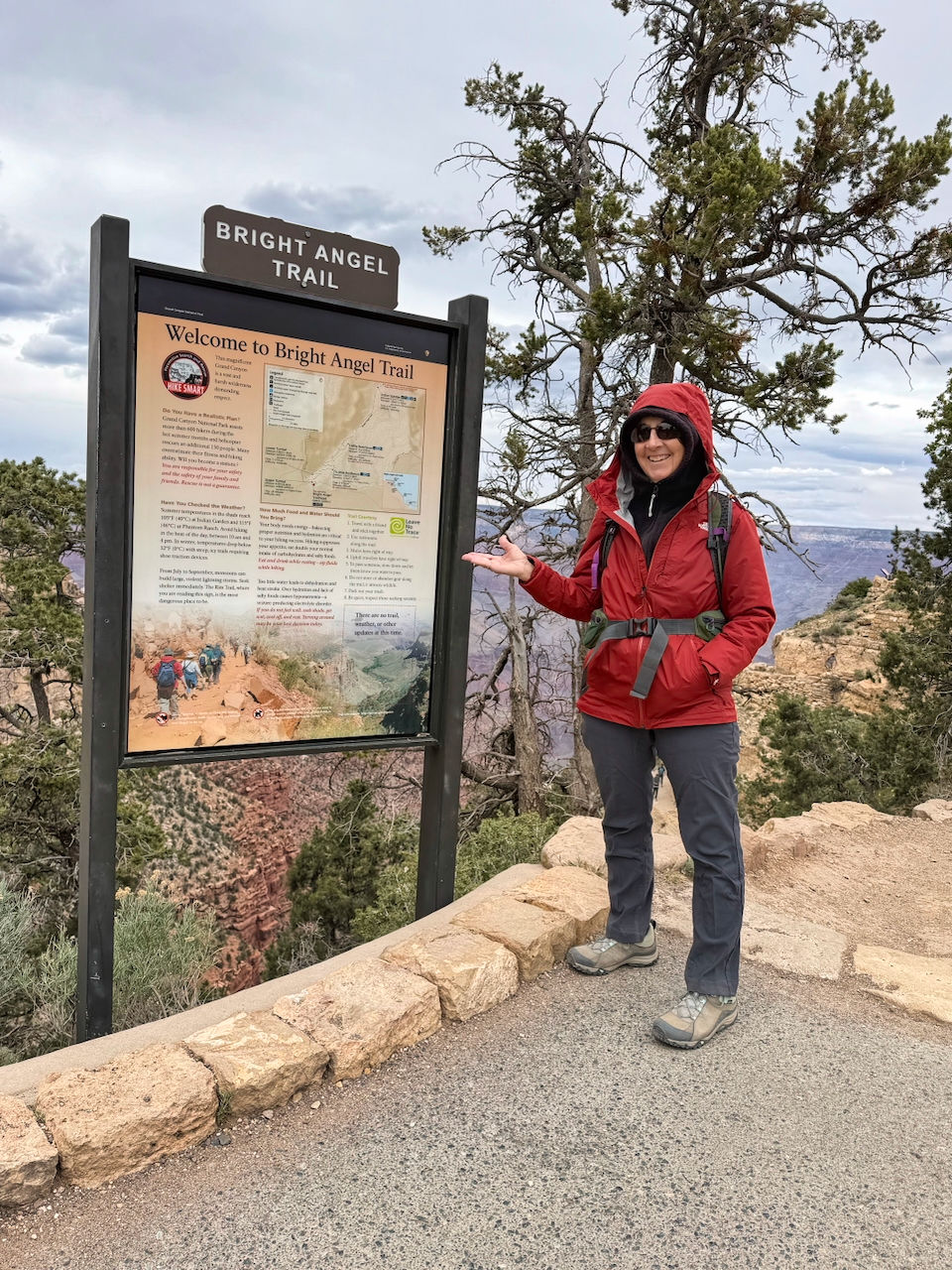
We also revisited the trailhead for the Bright Angel Trail, which starts right at Grand Canyon Village. Jeannette was sporting a "Been there, done that" attitude.
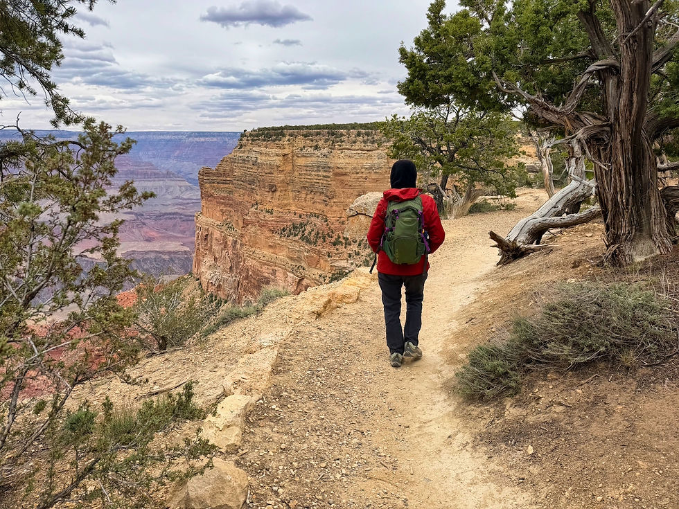
You can see the Bright Angel Trail snaking downhill in the video below.
When we visited the Canyon in 2020, we rehiked the first portion of the Bright Angel Trail down 1.5 miles and 1,100 vertical feet to the first water station. During 2020, we'd already been at altitude for a month before we came to the Canyon, which made it easier.
This time, being in the thinner air for the first time and with knee and foot surgeries in our not distant past, we limited our hiking to the canyon rim. Visiting the western section via shuttle bus, we got off at one stop and hiked a little over a mile to another stop. We ran into a few other hikers, but mostly had this section of the Rim Trail to ourselves.
Page
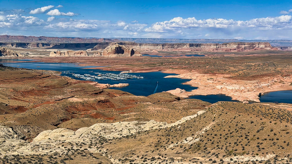
Leaving the Grand Canyon, we moved to Page on Monday, April 27. Page sits near the Arizona-Utah border and is the gateway to Lake Powell, formed by the Glen Canyon dam completed in 1963. You can walk along the bridge across the gorge, and get wildly different views from each side. Lake Powell reached its maximum height in the late 90s, and since then the water level has gotten dangerously low (supposedly the reservoir is only at 25% capacity, and the dam may be unable to generate power in a few years if things continue). The "bathtub ring" along the canyon shows the previous lake level.


We stayed at the Elks Lodge in town. Our last visit to Page had been in 2019.
Page is famous for Antelope Canyon, a colorful, narrow slot canyon that has spawned many an Instagram moment. It's located on the Navajo Reservation. Normally, in people's photos, you see it looking something like the photo on the left. What you don't see - but should as it is such an iconic tourist attraction - is that it frequently looks like the photo on the right.


We wanted some slot canyon action while we were in Page, but we shyed away from the popular Lower Antelope Canyon and Upper Antelope Canyon. Instead, we signed up for visits to a couple of other slot canyons.
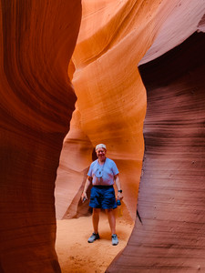
On Tuesday (our 42nd wedding anniversary), we took the Secret Canyon and Horseshoe Overlook Tour. Secret Canyon is on privately-owned land, and the Navajo family that owns it keeps tour groups small, with only one or two groups in the area at a time. After a six-mile drive through back country, we hiked through the canyon, which narrows as you move through, then came back through the other direction. The canyon was beautiful and uncrowded, and we had plenty to time to take pictures.


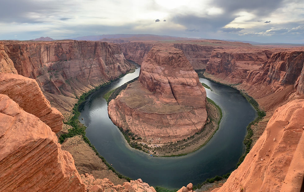
After we exited the canyon, we drove to a private overlook to see Horseshoe Bend, a feature of the Colorado River made famous by an old Windows screensaver. The site now sees some 3 million visitors each year.


On our second full day in the area, we arranged to take a half-day raft trip from Lee's Ferry in Arizona (the departure point for raft trips down the Colorado River through the Grand Canyon), headed north on the Colorado to Horseshoe Bend.
We met in Page, and then a bus took us an hour's ride south and west to Lee's Ferry to join our raft.

Although the walls on this section of the river are not as deep as the Grand Canyon, they still rise over 1,000 feet above the water.


Our arrival at Horseshoe Bend gave us a completely different perspective than the view from the top.


Just beyond Horseshoe Bend, we stopped for a bathroom break and to see some petroglyphs.


We also saw wildlife along the way, including a great blue heron and a group of wild horses.


On our final morning in Page, we took the Antelope X canyon tour, visiting part of the Antelope Canyon upstream from the more famous Upper and Lower canyons. This tour is also family run on privately-owned land. To start the tour, we had to hike down 220 feet, either on sloping sand or steps.

Rather than one long slot canyon, you visit a couple of shorter ones. These were narrower and more twisting than other slot canyons we'd visited in the area. The walls were also higher.


Leaving Page on April 30, we crossed into Utah, with planned visits to the five national parks in the southern half of the state. More about that in future blog posts!

Comments