
Zion, Bryce Canyon, Capitol Reef
- dougsmith51
- May 16
- 9 min read

Utah has 5 national parks, all in the southern half of the state, and we planned to visit them all. We crossed into Utah from Arizona on April 30, changing time zones (to Mountain Daylight Time) in the process.
Zion National Park
Our first destination was a small campground in Mount Carmel Junction, which lies close to eastern entrance to Zion National Park. Zion is the 2nd most visited national park, and most people come to it via the town of Springdale on the southern side of Zion Canyon. We've stayed in Mount Carmel Junction during past visits to the area, and prefer the quiet and the shorter lines to get into the park. This was our third visit to Zion, following visits in 2019 and 2020.

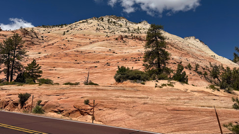
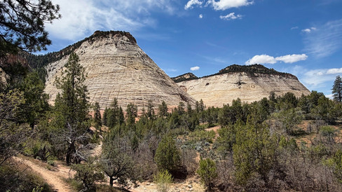
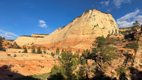
On our first full day in the area, we drove into Zion. Coming from the east, you pass through a higher area of the park with beautiful areas of white, yellow, and red slickrock formations.


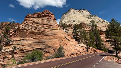

You then pass through a long and dark tunnel and many road switchbacks to get to the more famous Zion Canyon.

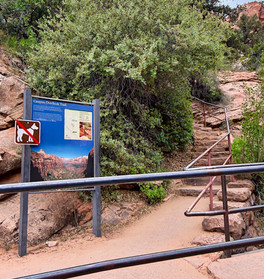
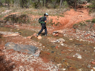
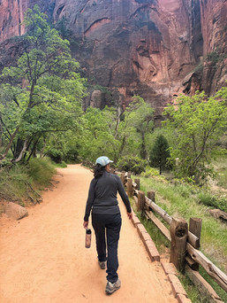
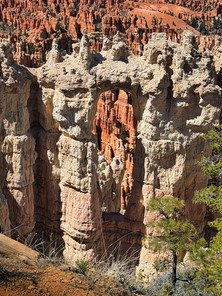
Right before the tunnel is the trailhead to the Canyon Overlook Trail and, managing to snag a close-by parking space, we decided to hike up to the viewpoint. After an initial steep uphill of carved steps, the rest of the mile-long trail is relatively flat, passing over rocks and through overhangs, until you reach the overlook.


Returning to the Fittata, we drove through the tunnel and emerged into the awe inspirting beauty of the Zion Canyon layed out before us. A series of switch backs took us down into Zion Canyon. Once there, we took a shuttle ride into the canyon (no cars allowed) to refamiliarize ourselve with the landscape.

We arrived back at the visitor center and returned to our campground amidst beautiful "golden hour" light that illuminated the landscape.


The next day we met up with our friends Stefan and Kerstin from Desert Trails RV Park, who were staying for a month or two in the nearby town of Kanab. We visited the Best Friends Animal Sanctuary. We weren't familiar with Best Friends, but it's a huge organization that works with over 6,000 animal shelters nationwide with a goal to eliminate animals being killed because they haven't been adopted. They take animals from all over the country, bring them to their shelters, and work to get them adopted.

We took a tour of the Sanctuary, founded in 1984 by a group of friends, and currently housing over 1,600 animals (dogs, cats, birds, horses, and other domestic and wild beasts) and comprising 5,800 acres of beautiful desert canyons.


After our tour, we ate lunch at their cafe overlooking the canyon. Just $5 for a vegan all you can eat lunch of salad, pasta, and dessert!

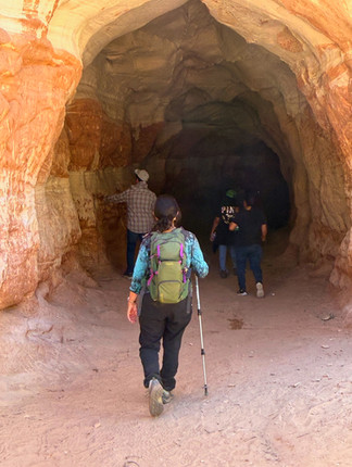
Later that day, we hiked a trail near our campground called Belly of the Dragon. It goes through a naturally carved tunnel that passes under a highway, then continues up a sandy wash.


We then traveled to nearby Coral Pink Sand Dunes State Park. Here, over the eons, wind has eroded sand from the nearby navajo limestone cliffs that has collected in dunes several miles long.

In the "unanchored" sections (no vegetation holding the sand down) people ride down the dunes on sandboards and all-terrain vehicles are free to drive around.
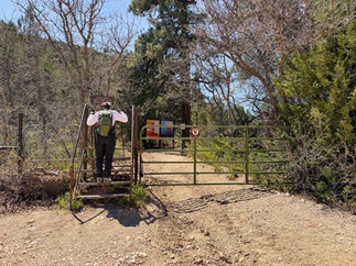
The next day we drove an hour-and-a-halfwest to the town of St. George, Utah to pick up some medications from CVS (they're fewer and farther in this part of the west), then headed north on I-15 to visit the Kolob Canyons section of Zion National Park. While part of the same park, you can't drive from the popular Zion Canyon section to Kolob Canyons - you have to go around and come in from the west.
Kolob Canyons is much less crowded that Zion Canyon, and has the stunning beauty of red rock walls punctuated by a series of side canyons.

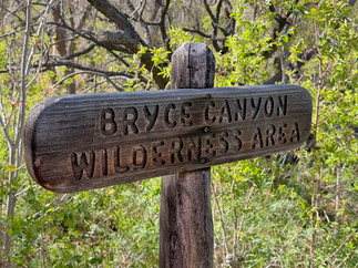
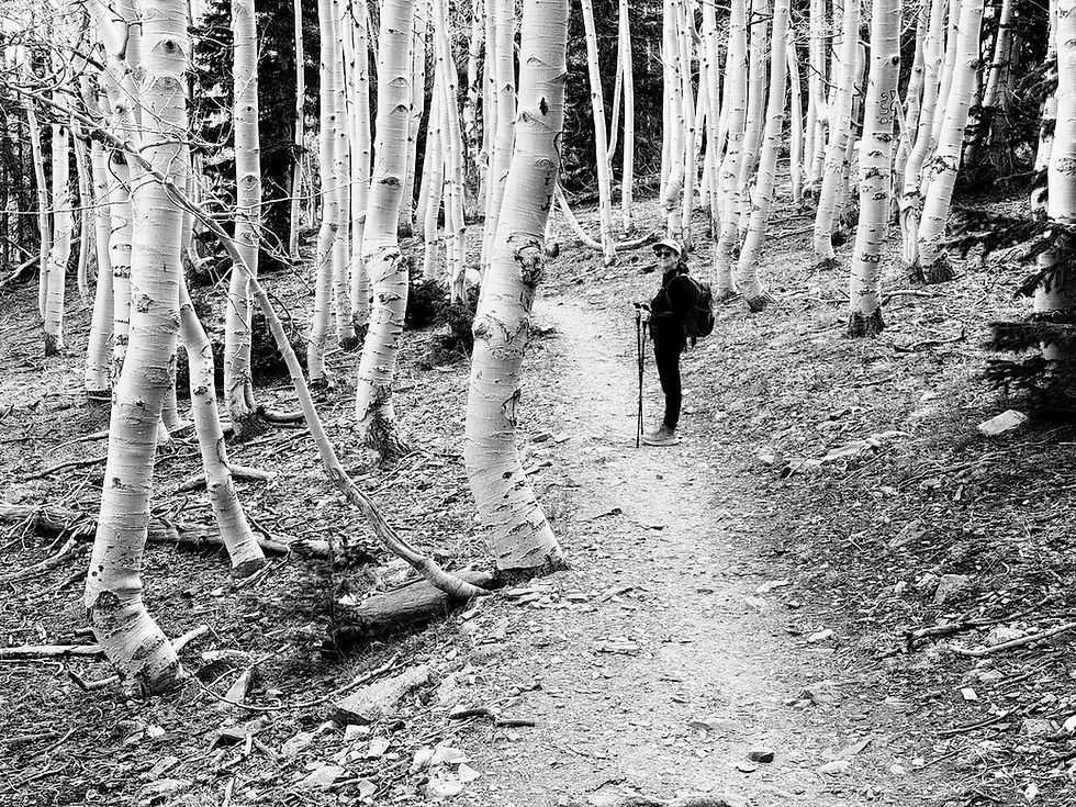
We did a couple of hikes in the area, including up Taylor Creek into one of the side canyons and the wilderness section of Zion. The hike involved many crossings of Taylor Creek!


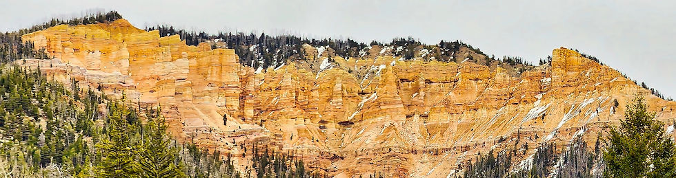
On our drive back to Mount Carmel we passed by Cedar Breaks National Monument, a colorful amphitheater with similarities to Bryce Canyon. Situated at 10,000 feet, it still had snow on the ground and would not open till late May.
The next day we traveled down to Kanab to spend the day with Stefan and Kerstin. In addition to lunch and a lot of conversation, we hiked the Tom's Canyon trail near town.

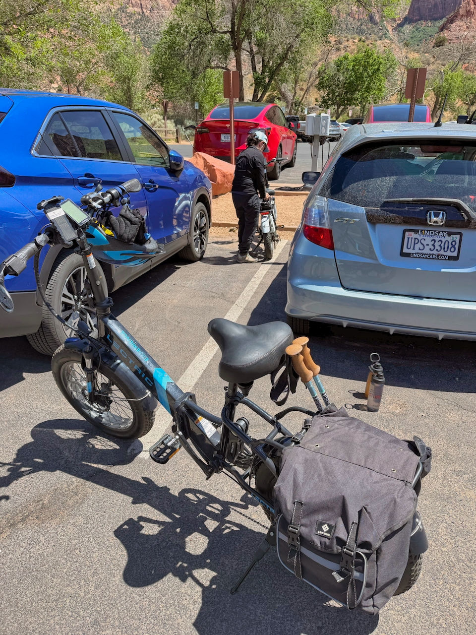
On our last full day in the Zion area, we drove down to Zion Canyon, parked near the visitor center (very lucky - Zion is super-crowded), got our e-bikes out of the back of the Fittata, and set them up.
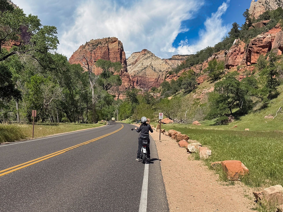
We then rode all the way to end of the Zion Canyon road (only bikes and shuttles are allowed on most of the road).
We passed a wild turkey along the road - a Tom who was trying to impress the ladies.

Parking our bikes at the end of the road, we hiked the one-mile-long Riverside Walk along the Virgin River.


Along the way we spotted a Great Blue Heron.

The Riverside Walk leads to The Narrows, a famous Zion experience. In our previous visits to Zion (both about this same time of year), the river was running high. The winter of 2025-6 had produced very little snow, and the river was low enough to allow people to hike up the The Narrows.


We had debated hiking The Narrows ourselves. However, it is primarily a wade up the river as the canyon narrows and the walls grow higher. Having spent some time recently in slot canyons, we decided that to hike it ourselves would be mainly about bragging. We enjoy hiking and seeing new vistas, but this canyon promised no new vistas and promised a challenging experience hiking in 58 degree water over slippery rocks, which we decided to forgo.
We hiked back to our bikes and rode the 10 miles back to the visitor center, packed up, and drove back to the campground under beautiful golden hour light.


Bryce Canyon National Park
On Wednesday, May 6, we drove about an hour north to Bryce Canyon National Park.

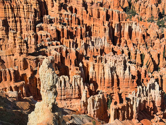
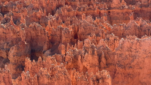
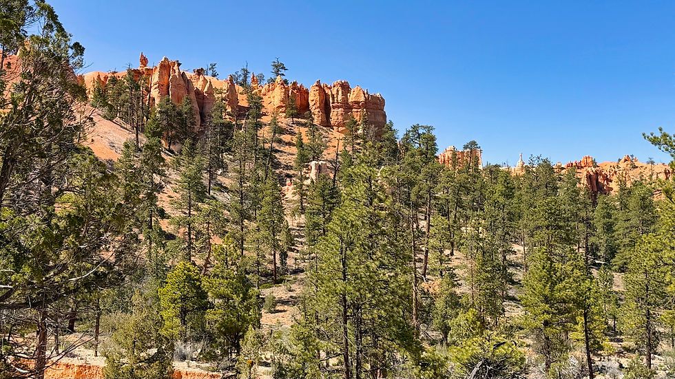
The name Canyon is a misnomer - Bryce is actually a one-sided amphitheater where the side of a plateau has worn away, exposing beautiful layers of colored rocks and many "hoodoos" - towers that have eroded away from the side and where harder cap rocks have prevented the towers underneath them from eroding away.

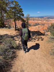
Although you can drive in the park, shuttles take you to the overlooks and best spots, so our first day we took the shuttle to Bryce Point, at the far end of the amphitheater. We then hiked two miles along the Rim Trail to Sunset Point, getting beautiful views from every vantage point. In the late afternoon sun, the rocks fairly glowed.


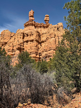
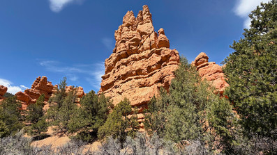
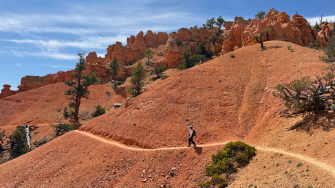
The next day we drove to nearby Red Canyon, a Dixie National Forest area that you drive through on the way to the Bryce Canyon, but which few people stop to explore. We parked at the information center, and hiked the appropriately named Birdseye Trail.


On our last full day at Bryce Canyon, we drove to the end of the park road, which extends about a dozen miles beyond the amphitheater portion, to Rainbow Point. It lies at 9,000 feet, a full 1,000 feet higher than the amphitheater. From there, looking in one direction, you can see the whole exposed plateau.

Looking the other direction, you can see Navajo Mountain in Arizona on the horizon, some 55 miles away.

While we were at Rainbow Point we hiked the mile-long Bristlecone Trail, which leads to a small grove of bristlecone pines. Bristlecones are the oldest trees in the world. Some have reached 5,000 years of age, although the oldest bristlecones here were about 1,500 years old. Most of these trees were not in great shape, with erosion having done some damage to their roots over time.

We found a younger bristlecone (perhaps 300-400 years old) that seemed to be doing quite well.

Bristlecones have close-knit, waxy needles that cover the entire branch.

Driving back toward our campground, we stopped at several viewpoints, including this one featuring a large natural bridge.

During past visits to Bryce Canyon, we had hiked down from the rim, through the hoodoos, to see what the plateau looks like from the bottom. This time, as an alternative, we drove down and then in to the eastern boundary of the park to hike the 1.5-mile-long Tropic Trail, which leads slowly uphill to the cliffs. We loved the color contrast of the blue sky, green trees, and pink cliffs.


Capitol Reef National Park
On Saturday, March 9, we drove about two hours to reach Capitol Reef NP.

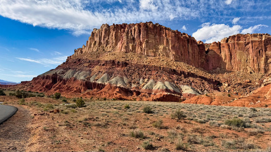
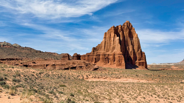
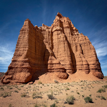
Of the five Utah national parks, this one is by far the least visited, due more to its more remote location rather than any lack of grandeur and beauty. The park gets its name from two features. First, a mesa that looks like the dome of the U.S. Capitol Building:

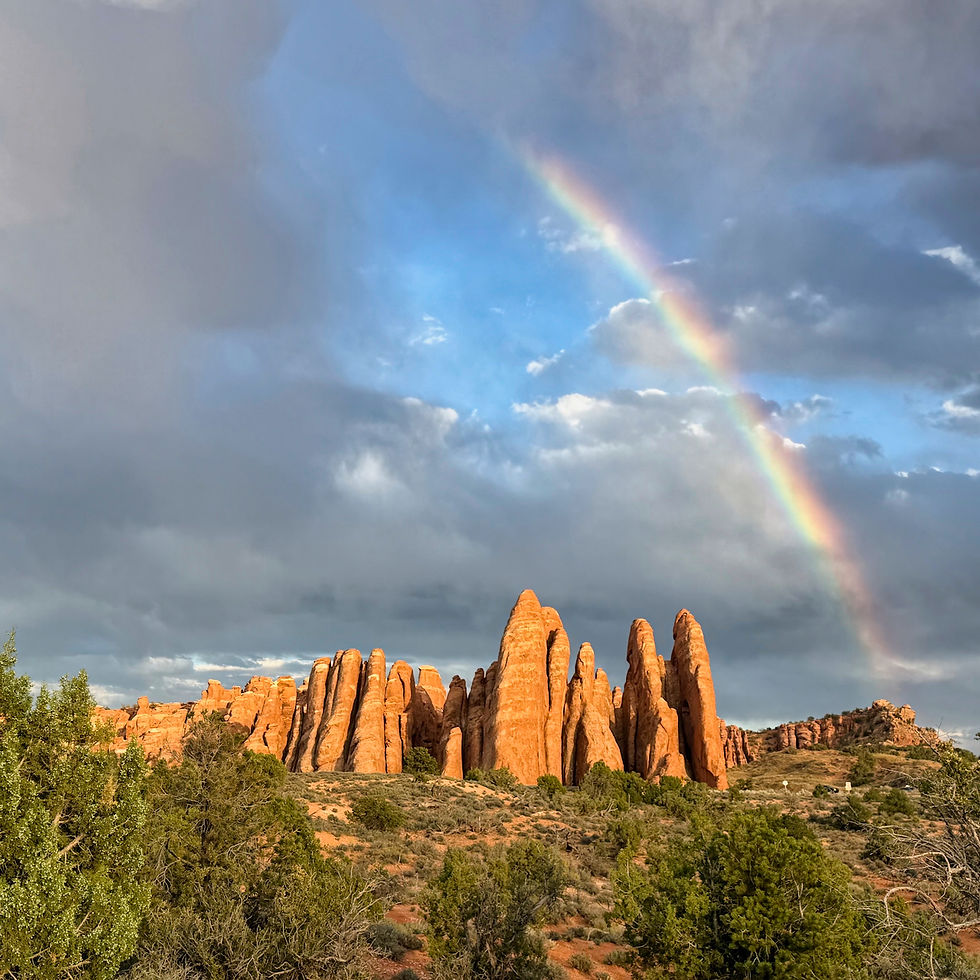
And second, from a hundred-mile-long chain of cliffs called the Waterpocket Fold that is a wrinkle in the earth's crust, which early settlers likened to an impenetrable ocean reef:

The cliffs show off colored layers of red, yellow, and orange, and a distinctive green layer in some places.


On Sunday (Mothers Day) our kids hosted a FaceTime call with Jeannette in the morning. In the afternoon, we signed up for private backcountry tour to an area of the national park called Cathedral Valley. Capitol Reef has a 10-mile long paved scenic drive, but it only reaches a small portion of the park. Cathedral Valley is only accessible by 4WD vehicles.

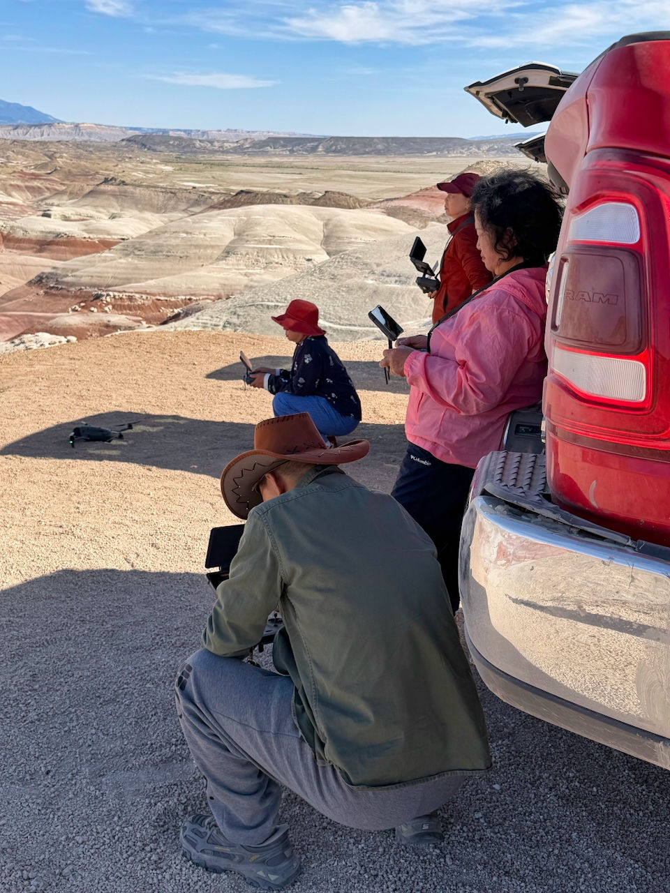
Our driver LizAnne picked us up at our campground, and we drove through Capitol Reef to the other side, then onto BLM land and an area called the Bentonite Hills. Bentonite is an absorbent, swelling clay derived from volcanic ash, and the hills look similar to what you see in a badlands area except more colorful. There were many beautiful hues.


At one viewpoint, we came upon three cars. Six Asian tourists were all individually flying drones. A class? A contest? Bragging rights for videos back home? Who knows?
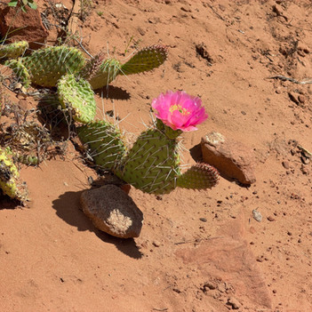
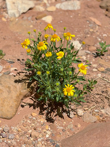
Even in the stark desert, we found wildflowers.


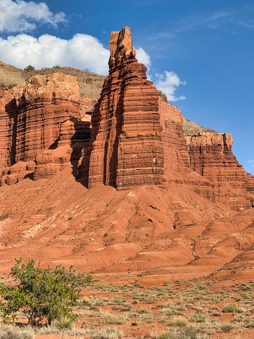
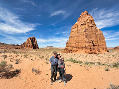
Crossing the border back into the very northern section of Capitol Reef NP, we visited the Cathedral Valley, dominated by two monoliths: the Temple of the Sun and the Temple of the Moon. In the picture of the two of us below, the 200-foot-tall Temple of the Moon seems to dominate the farther-away 400-foot-tall Temple of the Sun. The last picture is of Jeannette and our guide LizAnne.


As we drove back toward Torrey, we had a wonderful view of forested bottom land, bentonite hills, and mountains in the background. We also had to cross the Fremont River (fortunately not too deep, although our car had a snorkel).


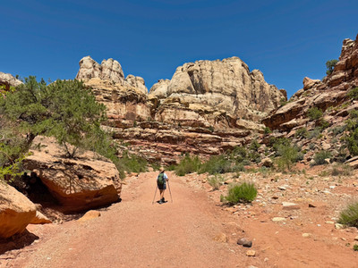
On our last full day at Capitol Reef, we hiked the 2.2 mile long Grand Wash Trail to its end, and then back to the Fittata. The Grand Wash is a periodic stream that, over the eons, has cut a path all the way through the Waterpocket Fold. As you hike through the canyon, it narrows and the walls are dramatically higher.


We also found some more beautiful wildflowers during our hike.


When my Mac upgraded its operating system to MacOS 26 Tahoe, my desktop got a new screensaver. See below.

After some research, I learned that this dramatic formation, Factory Butte, is in the Capitol Reef area. After we finished our Grand Wash hike, we drove to see it. Unfortunately, the area is surrounded by a fence (probably to keep ATVs from driving on the lower slopes), so this was as close as we could get.

On Tuesday, May 12, we moved again, to Moab. We'll cover that in our next blog.

Comments