
Moab
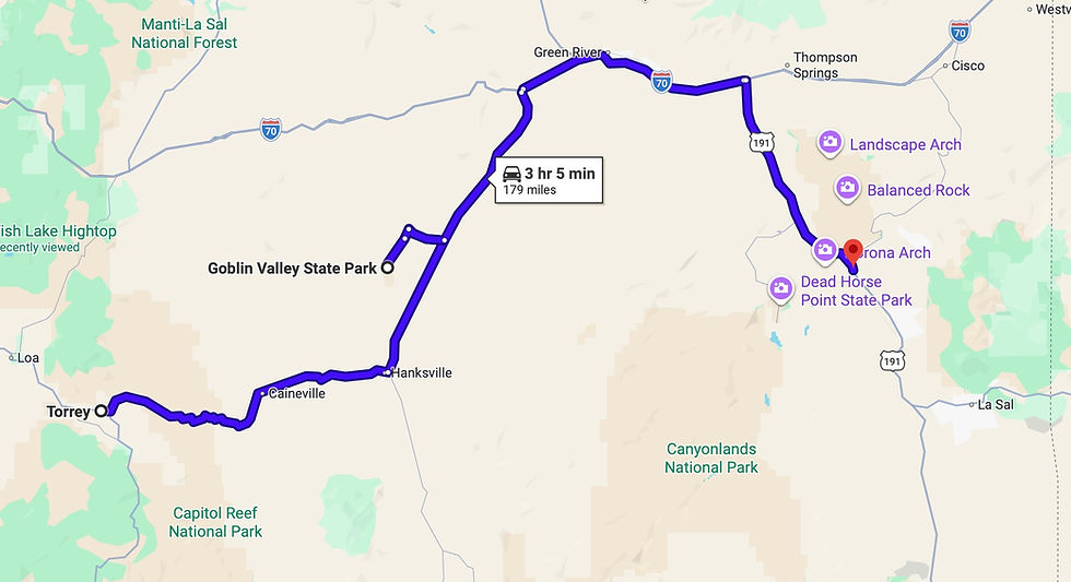
We traveled to Moab on May 12, and on our way from Capitol Reef National Park to Moab we stopped at Goblin Valley State Park (which according to at least one list is "The Best State Park in Utah").
Goblin Valley State Park

The valley is full of compact hoodoos that look like they're made of mud but are in fact Entrada Sandstone (the same material that makes up Arches National Park). Hoodoos are rock formations that have very solid stone on top and softer layers of stone beneath. The cap rock prevents the softer rock underneath from eroding away, leaving stone tower in place.
Up close, some of the hoodoos look like they have mud underneath, but when you touch them you find it's solid stone.

Moab
After two hours drive further east, we arrived in Moab for a 9-day stay. We camped at the KOA just south of town. Moab is the gateway to both Arches National Park and Canyonlands National Park. It's also a mecca for all-terrain vehicles and backcountry exploration. This was the fourth time we'd cycled through Moab since we started traveling with the Ciaowagen in 2019.
Moab is a town that feels like it's grown too popular for its own good. Our previous visits were all post-Memorial Day, and the town was crazy crowded. Fortunately, this time we were visiting before Memorial Day and the vibe was more reasonable. One concern we'd had was that getting into Arches NP would be very challenging because the National Park Service had suspended its Timed Entry Permit system after several successful years. However, we never had to wait more than 1-2 minutes to get through the gate and were always able to find a parking spot near the sites we wanted to visit.

One thing we really like about Moab is a food truck park located right in the center of downtown, with more than a dozen good trucks. We ate there several times.
We cycled in and out of national and state parks during our visit to the area, so we'll organize the entries by parks and activities rather than strictly chronologically.
Arches National Park

As mentioned above, the arches of the park are made of the same Entrada Sandstone as the hoodoos in Goblin Valley State Park. However, these generally have a redder hue compared to the brown Goblins.
The Entrada formations were first fractured into thin rock fins.

Over time, sand and wind wore away at the fins, forming holes (arches, windows) that went through some of them.
Arches National Park has several distinct sections of formations, separated by swaths of crumblier hills. Our first explorations took us to the far end of the park road: the Devil's Garden area. To get there, we drove past formations called Park Avenue and the Courthouse Towers.


Nearby both are three formations that are very human-like.

After reaching the Devil's Garden area, we hiked the mile-long-path to one of our favorite arches: Landscape Arch.
When you first approach it, it's hard to pick out for the surrounding rocks.

Seen against the sky, though, you become aware of how impossibly long (300 feet) and thin Landscape Arch is.

Leaving the area that day toward sunset, we loved the contrast between the dark sky and the Golden Hour light on the rocks.
Another arch magically appeared high in the sky as we walked.
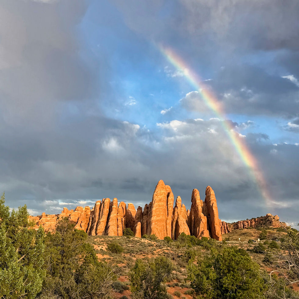
We were treated to a beautiful sunset. Right before the sun dipped below the horizon, the rocks practically glowed.


We returned to Devil's Garden another day during the Golden Hour to visit Skyline Arch...
...and Sand Dune Arch, which was hidden away in the rocks.
Continuing our Golden Hour explorations on yet another day, we traveled to The Windows area of the park, so we could view the light on the North and South Windows (together they make a pair of spectacles) and the nearby Turret Arch.


On our final day in the park, we returned to The Windows area to view Double Arch. It had rained during our stay in Moab, and snow fell on the La Sal Mountains, providing a beautiful backdrop.

Double Arch is stunning, and huge.
On our way out of the park, we drove to the lower viewpoint for world-famous Delicate Arch. If you've seen a Utah license plate, you've seen Delicate Arch.
We did not have time this trip to make the climb up, although Doug has done it twice: once in 1991 with our Dutch au pair Janine and once in 2020 with Jeannette.


We finished up our visits to Arches NP with a stop at the amazing Balanced Rock.


Utahrapter State Park

This state park, about 10 miles north of Moab, protects a fossil collecting area from which a number of specimans were taken, including those of Utahrapter, the official state dinosaur. It looks like it might have been a cousin of the velociraptor.

No bones have been left in place, so you can't see anything at the fossil site. However, close to the border of the park (on BLM land) is a dinosaur trackbed, including prints of both sauropod and theropod dinosaurs.
Dead Horse Point State Park

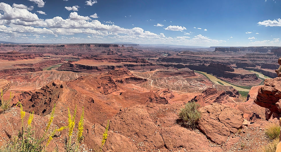
Dead Horse Point is a high plateau branching out to a narrow point with an amazing view of lower lands and the Colorado River. It's located close to the entrance to Canyonlands National Park. It got its name when it was used by horse thieves to corral wild mustangs they'd rounded up. Legend had it that some horses were left untended for a long period of time in the natural corral, and died from thirst.

Corona Arch
One day we decided to hike to a large arch we'd visited in the past: Corona Arch. It's not in the national park, but rather on BLM land in the Moab area.
After parking the car, there's a short steep uphill. Then you cross a train line that takes potash from the refining company weekly.
After that, the trail becomes easier as you hike into a canyon. There are a couple of challenges, including a steep section where you use a cable to pull yourself up and a ladder you must climb.
Turning a corner, two arches can be seen in the distance: Bowtie Arch, up high in a cliff, and Corona Arch, relatively freestanding.
On the way back down, we walked and talked with a lovely young woman from Colorado, Amber and her two dogs (yes, she carried them up and down the ladder). As we told her about some of our Ciaowagen and international travels, she said, "You should adopt me!"

Canyonlands National Park

Canyonlands is a very large national park with multiple sections. It can take hours to get from one section to another. We decided to limit our visit this time to the Island in the Sky section, which is closest to Moab, with an entrance just a mile beyond Dead Horse Point State Park. It's also the most dramatic section in our opinion. It has high plateaus that fall off to brown flat lowlands into which the Colorado and Green Rivers have carved dramatic canyons.
We drove to Grandview Point, which offers the best overall panoramic view of the entire park, then opted to hike the mile-long Grandview trail which extends beyond the parking area.
Both the Colorado and Green River rims are outlined with dramatic white edges (more about that later).
We drove to a couple of other viewpoints, then parked to make the short hike to Mesa Arch. It's an Instagram favorite, and there were many people there.

There were tiny prickly pear cactus by the trail, just 3-4 inches high due to the more extreme weather conditions on the plateau.

Looking through Mesa Arch provides dramatic views of the valleys below.
One evening we traveled to one of the viewpoints for an informative and entertaining astronomy talk by one of the park rangers. Canyonlands is a Dark Sky Park, and the stars were numerous and dramatic.
4x4'ing
Towards the end of our time in Moab, we rented a Jeep for some backcountry driving.

Headed west from Moab we drove on the Potash Road, which eventually turned into a dirt and rock road. We passed the potash evaporation ponds we'd seen from Dead Horse Point.

We also drove by one of the Colorado River's gooseneck turns.
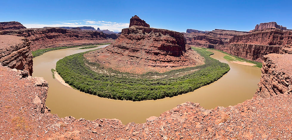
Eventually, we crossed the border into Canyonlands National Park.
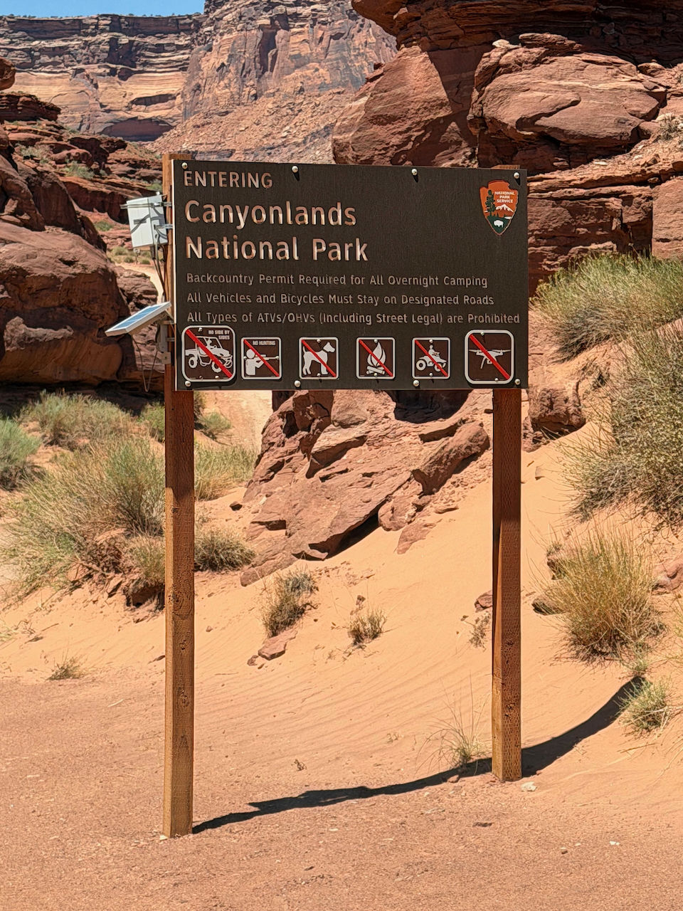
The rocks lower in the canyon are a dark chocolate color.
We turned and spent about an hour-and-a-half driving along the White Rim Road. The entire road is 100 miles long and takes at least two days to travel, so we only sampled a small segment.
From above, the white rim along the river canyons is quite distinctive.
Seen from up close, you can see that the rim rock is a very light colored limestone.

We stopped to look at Musselman Arch - it actually appeared to be more of a thin natural bridge.

Eventually, we turned our way north and climbed up the steep Shafer Road to the top of the plateau. The road was originally used to bring livestock up from the canyon. Seen from the bottom the road seems daunting . . .


. . . but seen from the top it is heart-stopping.

Having arrived back at the plateau top, we drove east outside Canyonlands park for a few miles, then turned onto the 26-mile-long Gemini Bridges Road to get back closer to Moab.
The first half of the road is a well-graded dirt and gravel road which leads you to the Gemini Bridges, two side-by-side natural bridges over a deep canyon. Along the way, we could see Entrada Sandstone fins, similar to the fins in Arches, with the La Salle mountains as a backdrop.

We were also periodically held up by grazing cows (the road is on BLM land, and leasing for grazing is one of the ways BLM raises money).

Halfway down the road is the parking lot for the Gemini Bridges, which is a short hike away.

When you cross over and look back, you can easily see there are two bridges right next to each other (hence the Gemini - Greek for "twins").

Slightly further back along the trail was an undercut that looked like it could be third bridge in a few thousand years.

The bottom half of the Gemini Bridges road is rougher, climbing over rocks and sometimes hugging hillsides with precipitous drops to the right side of the road.
We made it back to Moab safely, took the jeep to a do-it-yourself car wash to remove mud and dirt built up during the day, and dropped it back at the rental company.
Moving on from Moab, we traveled the entire width of Utah and crossed over the Nevada border into the small town of Baker, gateway to Great Basin National Park. More about that in our next blog post!


Your pictures from Moab look amazing and you both look happy and healthy. You have been on my mind. Miss you both!