
Colorado

Fort Collins
After completing our adventures in the Black Hills of South Dakota, we traveled southwest into Colorado, arriving in Fort Collins on August 4. While there, we visited our long-time friend Marge Brodahl at her retirement community and went out to visit the Colorado State University test garden, a floral paradise.
Rocky Mountain National Park
We then moved on for two whole weeks of exploration at Rocky Mountain National Park. During our previous visit in 2021 we'd arrived in October and the Trail Ridge Road which crosses over the park was already closed due to snow. This time, however, everything was open.
We settled into the town of Estes Park on the east side of the park for our first week, and then traveled to the town of Grand Lake on the west side of the park for the second week. This allowed us to poke in to the national park at our leisure.
We made several visits to the alpine tundra area above the treeline. The Alpine Visitor Center has a unique roof truss to keep it in place even during winter's high winds.

Near the visitor center you can hike up to a 360-degree viewpoint which is right at 12,000 feet in elevation.


Along the way there are exhibits about various alpine plants, which tend to be small and low to the ground. We learned that the microclimate within 2-3 inches of the surface can be much warmer than the air above it.
Trail Ridge Road is the modern (c. 1932) road that goes up to the alpine area.

You can also take the historic (c. 1920) Old Fall River Road up, which we did one day.


Another great hike in the alpine area is the Tundra Communities Trail, which is entirely above treeline. One of the reasons Rocky Mountain NP was established was to protect the tundra environment.


Rocky Mountain NP is one of the few national parks that continued their timed-entry permit system in 2026, and it ensured that the park was never too crowded. We'd reserved permits in advance for most of the days we were in the area. We also got additional permits to visit the super-popular Bear Lake area, and went there twice.
On the first visit, we hoped to hike the trail from Bear Lake up to Emerald Lake, something we'd done during our 2020 visit to the park. During our 2026 travels, we've been aware of how the relentless march of aging has cut down on our energy and hiking stamina. However, we wanted to prove to ourselves we could still rehike some of our old favorites (albeit with more fatigue and aching at the finish), so we tried for Emerald Lake. The Bear Lake parking area is pretty small, so we parked at a staging area along the road and took the free park shuttle bus to the lake trailhead.
Along the hike up, we passed lily-covered Nymph Lake and beautiful Dream Lake.
Emerald Lake sits in front of high cliffs and the view is quite dramatic. We had our lunch, visited by aggressive chipmunks and a marmot begging for food (we refused).


We were pretty knackered by the time we got to the shuttle stop. The 600 vertical feet back down (with lots of steps cut into the path) was particularly hard on the knees. But we'd made it!
We came back to the Bear Lake area a couple of days later and hiked around Bear Lake itself, which is on the small side but quite beautiful.
Then we hiked another trail (mostly downhill this time) to Alberta Falls.
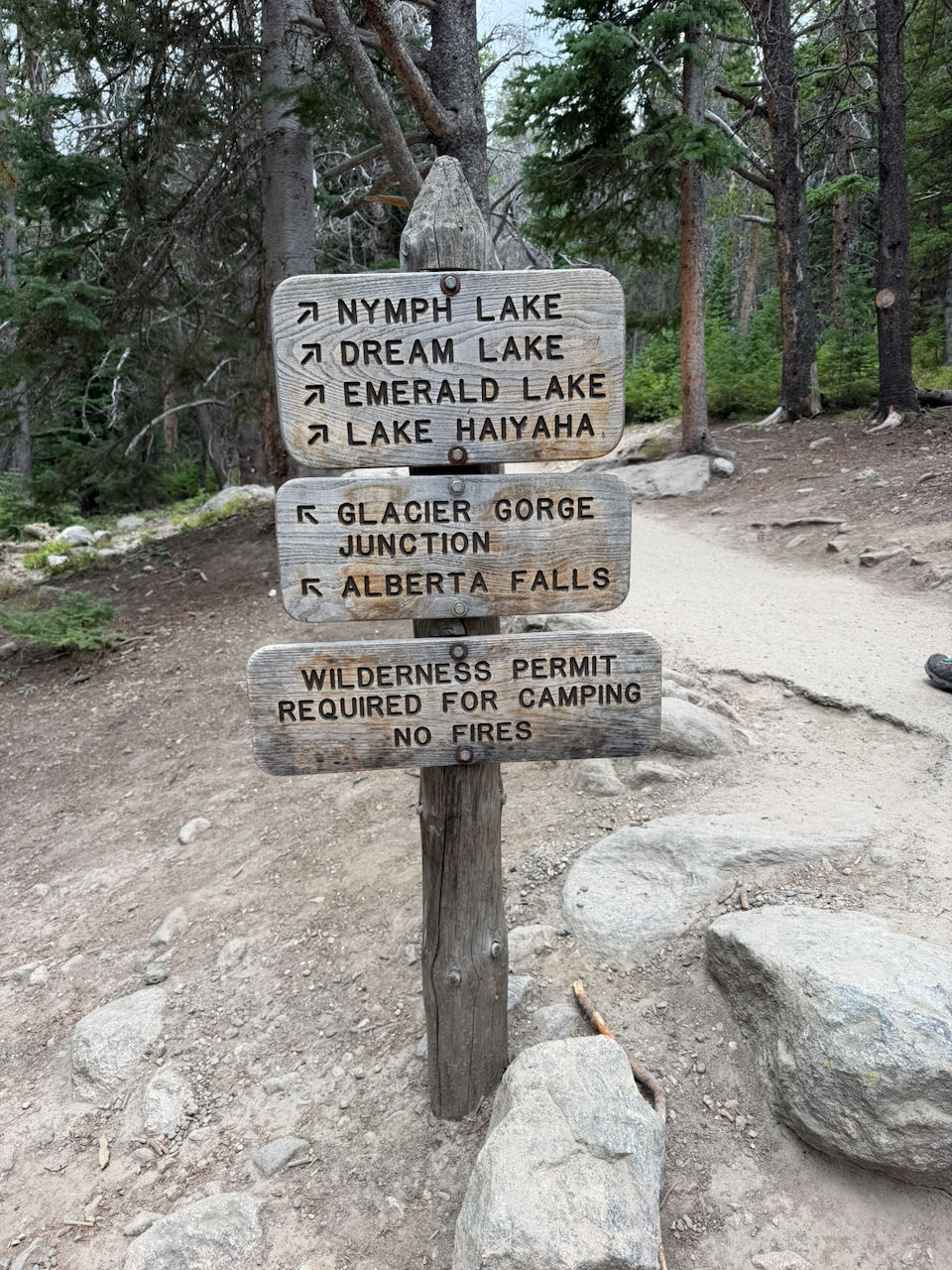

As we were hiking back from the falls to the Glacier Gorge Junction shuttle stop, we started hearing thunder in the distance, and before we were able to reach the stop the skies opened up. Fortunately, we usually carry our Gore-Tex jackets with us in our backpack so while we got wet, we weren't soked on the bone.

During our stay on the park's western side, we also did several hikes. The Coyote Valley Trail is a nature trail that goes along the Colorado River, whose source is in the mountains just a few miles north of Coyote Valley. Here, it's hard to describe the river as "The Mighty Colorado" because it's more like a stream. The water levels were also lower this year due to the lack of substantial snow in the mountain west last winter.

On our way along the trail, we ran into some moose with their calves. We kept them at a respectable distance, and were careful not to get in between the moms and young ones.

A bit further up the road is the Holzwarth Historic Site, a preserved relic of an old farm (later, a dude ranch) The western portion of Rocky Mountain NP was a later addition to the park and included several in-holdings like this one.

Later that evening, we returned to the Holzwarth parking lot to take in the stars and the Milky Way. You can see so much more with the thinner air and lack of distracting artificial light!
On our last full day in the park area, we traveled further up the river canyon, hiking the Colorado River Trail to the ruins of Shipler Cabin.
While staying in Grand Lake, we did one other RMNP hike along the shores of Shadow Mountain Reservoir. The trail lies just inside the border of the national park, and is close to the Continental Divide.
One day we traveled about two hours south to drive the Mount Blue Sky Scenic Drive - the highest paved road in America. To keep the road trip safe they use a timed-entry permit system. Once you get above tree line there is still seven miles' drive to get to the summit!
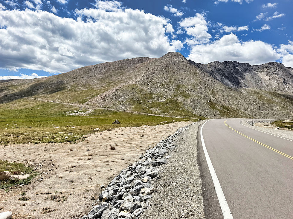
At the top, we left the Fittata in the parking lot (elevation 14,130 feet) and visited the ruins of an old cafe/gift shop that burned in the 1970s.
We decided to hike the 1/4-mile trail up to the actual peak, which sits at 14,264 feet, affording us a 360-degree view. We could look down to Summit Lake, which is "only" at 12,830 feet and is co-managed by the U.S. Forest Service and the City of Denver parks system. We could also see downtown Denver far to the east.

On the horizon we could see Pike's Peak, lying 52 miles to the south.

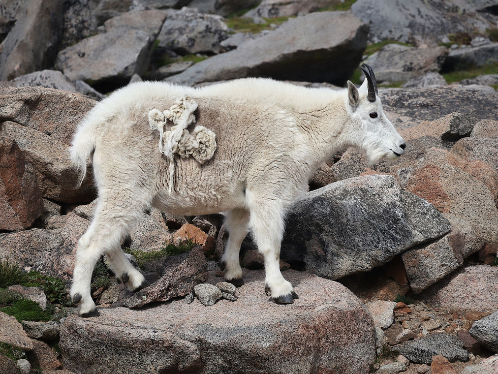
On our drive back down Mount Blue Sky we saw a marmot and a number of mountain goats.
We stopped to visit Summit Lake.


We also stopped to tour a grove of Rocky Mountain Bristlecone Pines. Some veterans were as old as 2,500 years. We also saw younger trees that might have ranged between 30 and 300 years old. It was nice to see a healthy selection of ages in the grove.

Carbondale
Heading west, we moved on to the town of Carbondale, located about 30 miles away from Aspen (where there aren't any campgrounds). Our primary objective was to visit the Maroon Bells, supposedly the most photographed mountains in the US!
It's easy to see why. The peaks, which do actually have a maroon tinge, are more than 14,000 feet high.

This is another place where they've had to enforce parking restrictions after the area was over-loved in the 1970s. We parked at one of the Aspen-area ski resorts and then rode a shuttle about eight miles up the road to the Bells.

Maroon Lake, which can offer dramatic reflections of the mountains, was at a pretty low level this late in the season. We hiked the two-mile-long loop trail alongside the lake and up Maroon Creek.

Beavers had been in the area, damming up one of the streams. As the lake shrunk over the summer, it looked like they'd moved from their shoreside lodge to one still in the water.
As we neared the shuttle stop, we ducked inside the shelter to avoid an intense hailstorm.

The next day we drove west from our campground to the small town of Marble, Colorado. We drove about five miles up a winding dirt road to see an active marble quarry.

Returning to town, we stopped to eat at one of the two restaurants in town. This one served great BBQ.

Montrose
We continued southwest to the town of Montrose. It serves as the gateway to Black Canyon of the Gunnison National Park, a less-visited but beautiful park showcasing a deep, dark-walled canyon carved by the Gunnison River when the area was uplifted about 2 millions years ago. The primary rocks, gneiss and schist, are ancient, about 1.8 billion years old.

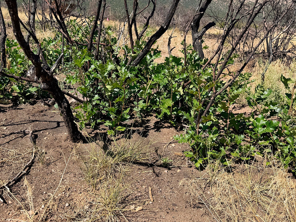
On our first full day we visited the South Rim of the canyon. There was a major wildfire there in 2025, affecting much of the rim. As in other wildfire areas, we could see that Mother Nature was already recovering.

The canyon is not wide like the Grand Canyon, but the canyon walls drop vertically almost 2,000 feet, straight down to the river. In the dark rock, dikes of light-colored pegmatite have intruded into the schist layers, yielding dramatic lightning-like patterns.


We hiked several trails that led to various canyon overlooks, and in unburned portions we saw gnarled old Pinion Pines and Juniper.

We also hiked along the South Rim Trail.

The North Rim is just 2,000 feet away but you have to drive an hour-and-a-half, completely around the park, to get to it, and so it is less visited. We went there on our second day in Montrose. There was a nice nature trail, and we found the views even more dramatic than the South Rim's.

Ouray (it's pronounced YOU-ray)
We moved another 30 miles south to the town of Ouray, which bills itself as "The Switzerland of America."

Ouray sits in a valley below high mountains.

It is the jumping off point for The Million Dollar Highway, a 25-mile highway built (at a cost of $1M/mile) as a wagon road in the 1880s and then rebuilt as a paved road in the 1920s. It's a beautiful route, winding up along mountainsides and past dramatic red peaks, leading south from Ouray to the town of Silverton. We drove the Million Dollar Highway to Silverton and back on our first full day in the area.
The next day we drove north to the town of Ridgway and then through Forest Service land to hike up Miller Mesa, following a snowmobile trail to dramatic views of mountains whose peaks rise above the tree line.

When you're down in a valley town like Ouray, you can see that you're surrounded by mountains but you can't really see what those mountains are like. The Miller Mesa Trail allowed us to take in those view. The trail was peaceful with a steady climb of about 450 vertical feet. It's about 1.5 miles each direction up and back.
On our final full day in Ouray we visited Box Canyon, a narrow gorge with scaffold bridges leading to a dramatic, hidden waterfall. The park is maintained by the town of Ouray.
Then we drove about an hour to the ski town of Telluride. Very upscale!

On the way back to Ouray, we stopped at Orvis Hot Springs in Ridgway. Nice to soak and relax after our recent days of hiking. We also booked a couples massage, which provided additional relaxation!
It was time to leave Colorado, and we departed on August 31 for Utah and a return to the town of Moab. More about that, and further adventures, in our next blog post.


Comments