
The Tetons and Glacier National Park

Our last blog posted documented our visit to Yellowstone, one of the crown jewels of the national park system, and America's (and the world's) very first national park.
Grand Teton National Park
On June 22, we drove south through Yellowstone to reach Grand Teton National Park, which sits directly below Yellowstone in Wyoming. We'd visited the Tetons with the Ciaowagen in 2019 and 2020.
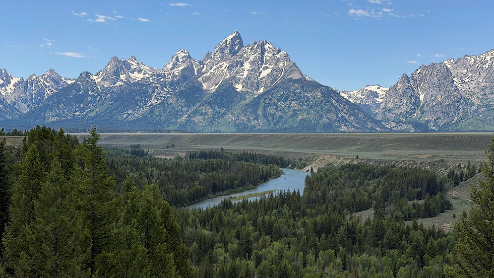
The park is about 45 miles long and 20 miles wide, encompassing most of the Teton mountain range. The mountains rise straight up (as much as 7,000 feet) from the flat plain on their east. There are no foothills. The Tetons sit by a geological fault line, and with each earthquake the mountains grow a little higher and the plain sinks a little lower.

Our stay in the national park was short, just a couple of full days. On our first full day, we drove to the top of the Signal Mountain road near the center of the park, for views of the flat plains, the Snake River, and the Teton mountains.
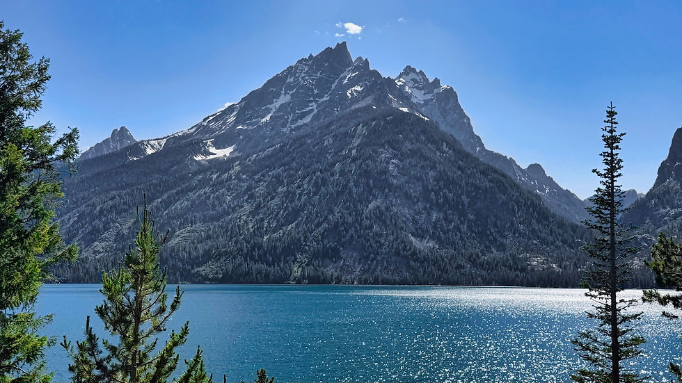
As at Yellowstone, the park was crowded with vacationing families. By going to some areas late in the afternoon, we were able to find parking spots. This included a hike along the shores of sparkling Jenny Lake, which sits directly below Grand Teton, the highest peak in the range.

On the morning of our second full day, we drove down to the small town of Wilson (below Jackson Hole) to have breakfast with Doug's high school friend Sue Zsamar Hunter and her husband Forrest.
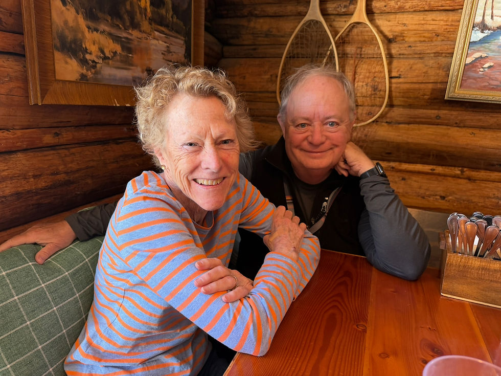
We'd seen Sue and Forrest in 2020 when we visited their 2nd home on the west side of the Tetons with an amazing sunset view of the mountains.

We spent the afternoon driving the 42-mile long Grand Teton Scenic Loop which offers many scenic vistas.


Along the loop, we stopped by historic Mormon Row, site of an old settlement. Its weathered buildings practically beg to be captured in black and white!
We also did a little B&W experimentation on some of the other Teton mountain scenes.


In the late afternoon, after we'd returned to the Colter Bay RV Campground in the northern part of the park, we hiked the 2.6 mile Lakeside Loop which traces the outsides of two islands connected by a narrow isthmus, and which offers views of the Tetons across Jackson Lake, a large natural lake made 30% bigger by a dam built in the 1910s.


Glacier National Park
It took two days of driving to arrive on the east side of Glacier NP, and we overnighted in Helena, MT on our drive north. We'd visited Glacier with the Ciaowagen in 2019 and twice in 2021.
We spent four days in the Glacier area, our visit partly marred by significant rains (the first major rains we'd experienced on our trip). We'd picked the east side of Glacier (which sits next to the Blackfoot Reservation) because it is much less crowded and commercial than the west side and because it offers access to multiple lake areas.
On our first full day in the area, we drove the iconic Going-to-the-Sun Road from east to west. Unfortunately, with the rain falling on still-snow-covered areas higher up, a dense fog set in about 1,000 feet below Logan Pass, and continued over the pass and down 1,000 feet on the other side. We'd hoped to do some hiking in the Logan Pass area during our stay, but it was not to be.
Once we're reached the eastern side of the park, we stopped and hiked the Trail of the Cedars, a boardwalk trail winding among a grove of ancient cedars with haiku signs along the way.
We drove out of the park on the west side and visited a campground we would be staying at in July, dropping off our CBD products which Canada prohibits from entering the country. We had a delicious dinner in the town of Whitefish, MT, then drove back to our campsite using a road outside the national park.
The next day the rains held off, and we drove up to the Many Glacier area in the northeast of the park. Unfortunately, due to climate change there are not many glaciers left and the ones that still exist may be gone before the century is out.
On our drive in, we passed a black bear (brown in color) eating about 30 feet off the side of the road.

We parked by the Many Glacier Hotel (built by the Great Northern Railway in 1915).

We decided to hike the three-mile loop around Swiftcurrent Lake, starting and ending at the hotel. The trail was beautiful and the air was fresh.
There was a riot of beautiful wildflowers including (clockwise from top left) Beargrass, Mariposa Lilty, Indian Paintbrush, Orange Hawkweed (also known as Fox-and-Cubs), Rosy Spirea, and Golden Ragwort.

We added a short side hike to the shore of Lake Josephine, just uphill from Swiftcurrent Lake.

Hiking trails further up the valley were blocked due to bear activity (several areas in the national park were closed due to bear activity).

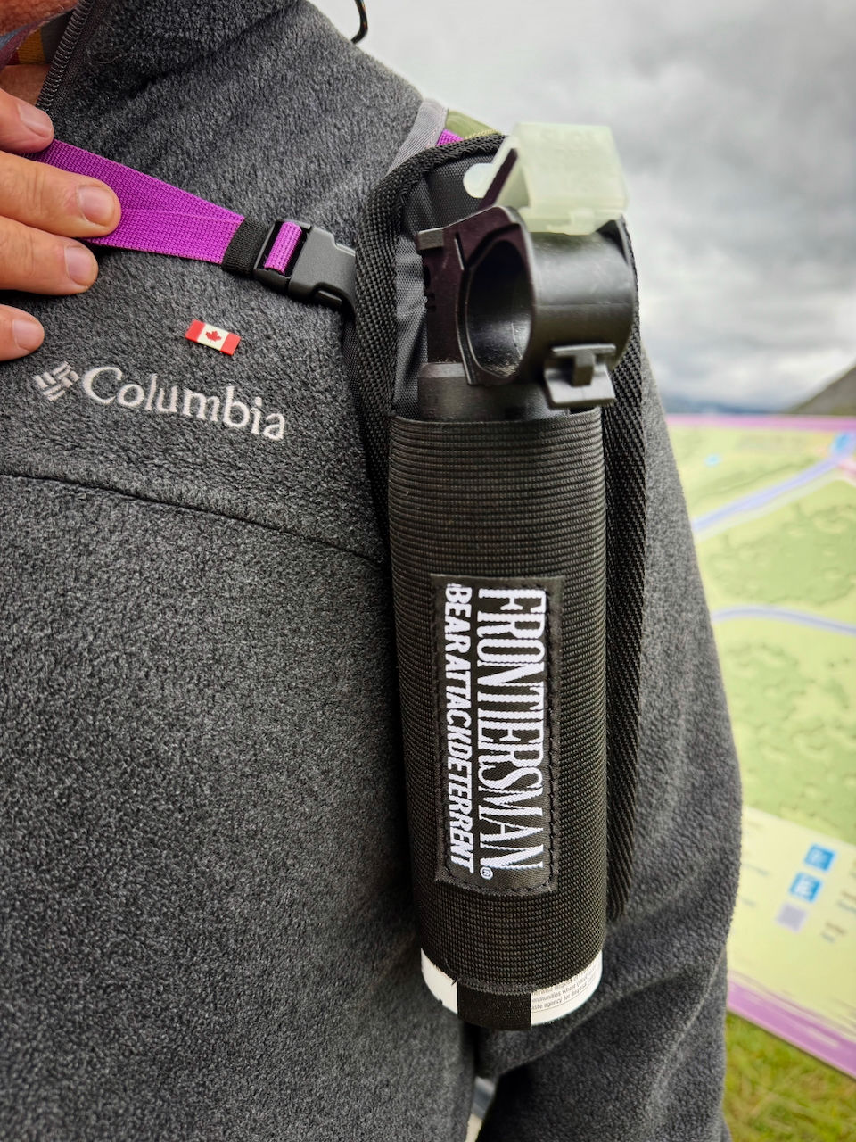
As recommended, we always have easily-accessible bear spray with us when we visit Yellowstone, the Tetons, Glacier, and the Canadian Rockies national parks.
The next day we drove south to Two Medicine Lake.

It was rainy (and would get worse during the day) but that did not cool our desire to get in a short hike...
...nor that of the many other people whose cars filled the parking lots.

We did a short two-mile out-and-back hike to Paradise Point along the lake's south shore.
Again, we saw many wildflowers.

The Two Medicine Lake area holds a special meaning for us, as it was the site of an early backpacking trip we took together in 1983 when we were still dating. Our acdvetures included hiking the north side of the lake, running into a black bear on the trail, cooking dinner and sleeping in a fenced enclosure higher up in the mountains, and hiking more than a mile on a 45-degree scree slope (that last one was particularly challening for Jeannette given her discomfort with heights).

On our last full day at Glacier there was about 4" of rain, so we cocooned inside the Ciaowagen for the day. We found out later that the Park Service had closed both the Many Glacier area and the Going-to-the-Sun Road due to flooding concerns.
The next day (June 30), we crossed the border into Canada. More about our time in the Canadian Rockies in our next blog post!


Comments