
Up and Down the Canadian Rockies

Leaving the Glacier NP rains behind, we crossed the border into Canada on June 30. There was no line at the Chief Mountain border station, and we crossed over in about two minutes.
In most of our Ciaowagen travel years, we run into a lot of Canadians at U.S. campgrounds. We've seen a lot fewer this year (probably since the most visited national parks now cost four times as much as they did last year for foreign travelers). Also, Parks Canada has been offering free admission to Canadian national parks this year - including for Americans. Finally, we love Canada and Canadians, so if the mountain won't come to Mohammed...
Waterton Lakes National Park
Our first destination was Waterton Lakes National Park, just over the border and co-managed with Glacier as the Waterton-Glacier International Peace Park since 1931.

On the afternoon of our arrival, we drove into the park and visited two natural areas close to each other. The first is Red Rock Canyon where a fast moving downhill stream has cut a channel through - wait for it - some very red rock. It's a popular area and there were lots of people on both sides of the channel.
At the bottom, the channel empties into Blakiston Creek. Following Blakiston Creek uphill on the other side takes one to the the very lovely Blakiston Falls. Parks Canada has built platforms overlooking the upper and lower falls.
Our last visit to Waterton was in 2021 as we were returning from our time in Alaska. That was four years after a disasterous 2017 fire that had burned almost 40% of the national park. In our 2021 hike to Blakiston Falls, we could tell that nature was recovering, with small pine trees along the trail.
This year we could see how much things had grown, with many of the pine trees now higher than our heads.

It will still be a couple of decades before the park fully recovers. You can choose to notice the dead tree stands, or you can marvel in nature's regenerative powers - we choose to do the latter.
The second day was July 1, Canada Day, which celebrates the 1867 Constitution Act which united three separate British provinces into the self-government dominion of Canada. The celebration in Waterton was low key at best, with a few people walking around town wearing headbands with bobbling Canadian flags.
We took a boat ride down 7-mile-long Waterton Lake, two-thirds of which is in Waterton Lakes and one-third in Glacier. We'd done the boat ride before and it's always a beautiful trip.
The international border is marked by a clearcut through the forest.

When we'd taken the trip in 2021, the boat turned around at the border due to COVID restrictions. This time, we were able to travel to the Goat Haunt landing in Glacier National Park and got off for a short talk by a National Park Service ranger.
Returning to Waterton, we had dinner, including this edible flower-strewn salad, at the very Victorian gingerbread-y Prince of Wales Hotel that sits on a hill above the town. The views down the lake from the main sitting room are spectacular.
Jasper National Park
Our next destination was Jasper National Park in Alberta, but given the long distance we overnighted at a Parks Canada campground in Banff. Then we drove up the beautiful 144-mile-long Icefields Parkway to our campground in Jasper.

We'd last been in Jaspar during that same 2021 Alaska trip. In the intervening time, there was a major wildfire in 2024 that burned much of the area and destroyed about 1/3 of the buildings in the town. Fortunately, much of the core downtown business district was saved, meaning that we could still take advantage of Jasper's great food scene (which we did, three nights in a row).
The fire burned above-ground for almost 2 months, and below-ground for an additional six months, leaving many evergreen trees looking unburned but dead nonetheless. As in Waterton Lakes, nature was making a return, although what we saw was mostly long grasses - any returning pines were too small to see in the high grass. The silver lining in this disaster was that wildlife was making a remarkable return, in fact the park now hosted a population of caribou, rarely or never-seen before the fires.

Before setting up in our campground, we decided to refill the Ciaowagen's gas tank. It turned out to be a prudent decision because one of the two gas stations in two (there had been four originally, but two burned in the wildfires) ran out of fuel the next day, resulting a three-block-long line for the remaining one.
On the trip north, there were not really opportunities for us to stop due to the combined 45-foot-length of the Ciaowagen, tow bar, and Fittata. Therefore, on our first full day in the area we drove the Fittata back down the Icefields Parkway for about 70 miles to take in the sights. The Parkway winds through a valley between high mountain ranges on either side.

One interesting thing about the Canadian Rockies is the way they were formed by uplift. It looks like a giant crack happened and then the land was tilted upward at an angle of 45 degrees or more.

The Parkway got its name from the many snowfields and glaciers on the mountains. NOTE: we first drove the Parkway in 1988 during a trip we took shortly after our son Tory was born but before Jeannette went back to work. The rapid retreat of the glaciers in the intervening 38 years was stark.

As we drove southward, we saw a group of cars pulled over to the side, so we stopped also. Doug, shielded by the car, was able to take a picture which we think revealed the back of a grizzly bear's head close to the side of the road. A few people - okay, we'll just say it, stupid people - stood by the edge of the road and close to the bear to get their pictures.

Fortunately, a park ranger came by, told people to get back in their cars, then scared the bear away from the road using an air gun.
At the highest elevation of the highway is the Columbia Icefield and the Athabasca Glacier. The glaciers were, as we mentioned, much further back from the road than they were in 1988.


During our drive, we also saw several beautiful roadside waterfalls...

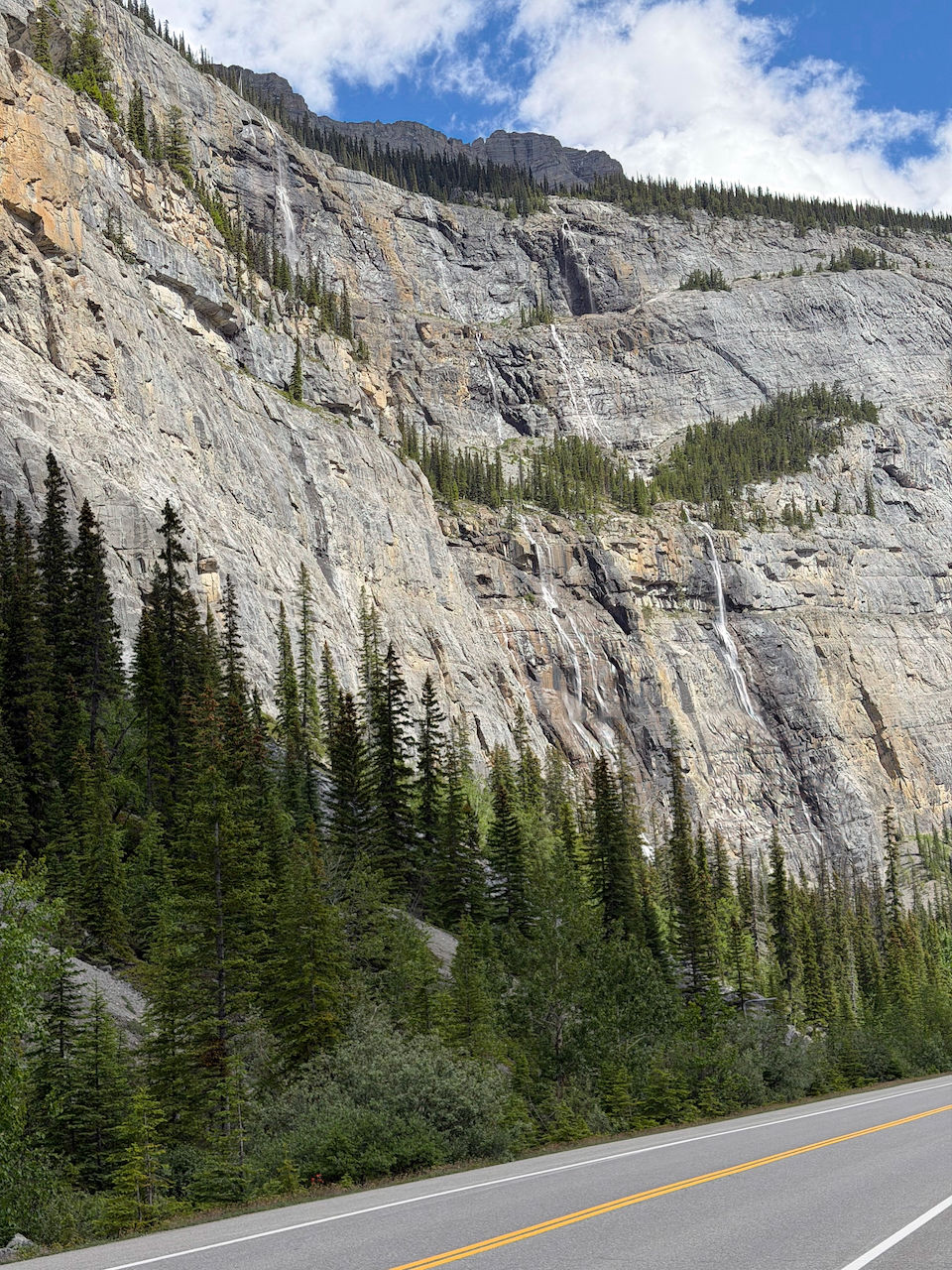
...and a cliff called the "Weeping Wall" because it was covered in small cascades.
On our return to Jasper, we got off the Parkway to visit beautiful Sunwapta Falls.

Further up the road, we stopped to see Athabasca Falls, including a very lovely rainbow.

The next day we drove about 20 miles east of our campground (but still in the national park) to Maligne Lake. It was a raining on and off, but we had our Gore-Tex jackets along and were prepared.

We hiked the Mary Shaffer loop trail, which tracked along the lakeside for a while.

The trail then turned inland, and became increasingly muddy and "root-y", and we picked our way along.

We drove back to our campground as the weather cleared. Along the way, we spotted a mother moose and her calf.
We also passed Medicine Lake on the way back. Here the mountain uplift is very noticeable at almost 90 degrees!

At a pulloff near the lakeside, we found both beautiful wildflowers and a couple of bighorn sheep licking salt from the ground.
With clearer weather, we decided to take the Jasper Gondola to get some scenic views of the area. The Gondola station is located about 4 km up a side road from the campground, and takes you to a ridge high above the valley.

From the top, you are able to hike another 600 feet higher to a 360-degree view. However, it was late in the afternoon and we did not have time (or, we thought, the stamina in thin air) to attempt that hike.
We did walk around the area near the gondola station, where there were many tiny wildflowers and moss clinging to the rocks.


It was late afternoon. Before heading into Jasper for dinner, we drove to nearby Pyramid Lake to hike out to and around lovely little Pyramid Island, a popular spot for weddings, picnics, and taking in lake views.

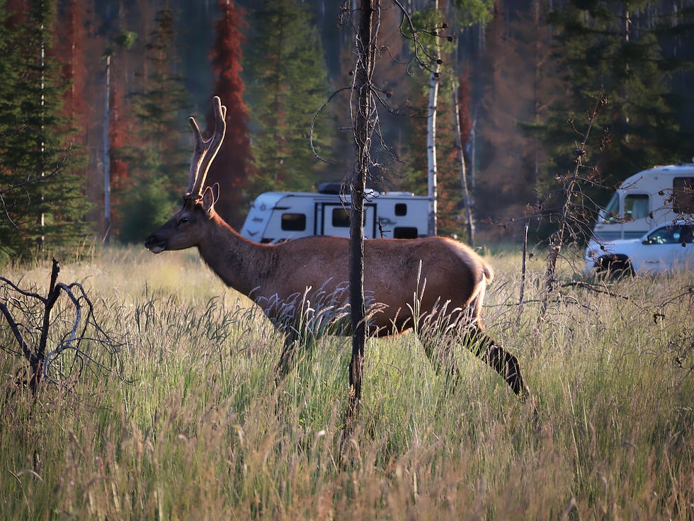
As we drove back to town, we saw a bull elk walking by the road in the campground.
We'd reached the northernmost portion of our 2026 Ciaowagen journey, and the next day we turned south, driving the Icefields Parkway one last time. It was a beautiful sunny day and we had a nice view of the Columbia Icefield and the Athabasca Glacier as we drove past.

Banff National Park
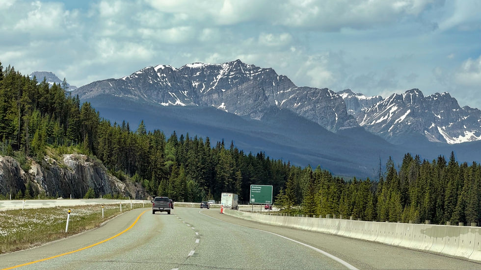
We settled into Banff for a few days, camping in Parks Canada's Tunnel Mountain Trailer Village (another very large campground complex), located about 1.5 miles from downtown Banff. Banff's setting is very dramatic, surrounded by high, craggy peaks easily seen from the Trans-Canadian Highway that runs through the park.
One of our goals was to visit Banff NP's Lake Louise. Unforunately, there's very little parking at the lake. Parks Canada operates a shuttle service but seat reservations ($12 Canadian/person) sell out in minutes when they become available online. Stopping by the Banff visitor center, we learned we could take a 45-minute bus ride on local transit to the lake ($25 Canadian roundtrip senior fare for both of us).

The Banff visitor center encouraged us to look for Parks Canada shuttle tickets again, and we managed to snag two tickets leaving 2 pm the next afternoon that would take us to Moraine Lake (more about that visit below). We'd last visited both Lake Louise and Moraine Lake during our 2021 trip through the Canadian Rockies returning south from Alaska.
The local transit bus ride was pleasant and left from a bus shelter just a 5-minute walk from the Banff town visitor center. Arriving at Lake Louise about 45 minutes later, we walked into the lakeside crowds we knew would be there.

The lake is an amazing light blue color from the glacial flour in the water. NOTE: we first visited Lake Louise during our 1988 trip with baby Tory. At the time, the glaciers reached much further down the mountains.

Since it was sunny day, we decided to walk the 1.5-mile-long lakeshore trail to the other end and back. The beach at the far end looks back on the iconic Fairmont Chateau Lake Louise. The trail was crowded at the start, but thinned out quickly.
After completing our hike, we waited less than an hour to catch the transit bus back to Banff.
The next day was our planned visit to beautiful Moraine Lake, which sits close to Lake Louise. The shuttle leaves from the Lake Louise ski area which is about a 40-minute drive west on the Trans-Canadian Parkway from Banff. We decided to go early, and ride the ski-lift for views back to Lake Louise and the surrounding mountains.
Unfortunately, when we got to the top, we found that smoke was coming into the area from wildfires west of us, obscuring some of the view.

Once back down, we ate lunch and went to the shuttle area to get our Parks Canada bus. There are commercial shuttle operators but they charge $100-150 Canadian/person. There is NO parking at Moraine Lake, so you have to take some sort of bus shuttle there.

Moraine Lake is also a brilliant blue, but a darker color than Lake Louise. There is glacial flour, but less of it, coming into the lake. Some of the best views of the lake come by climbing up a formation called The Rockpile that sits at one end, and we took this trail up.
After coming back down from The Rockpile, we decided we had time available to hike the lakeshore trail down to the far end of the lake. We saw many people toward the beginning of the trail, but the crowds thinned considerably as we moved toward the other end.
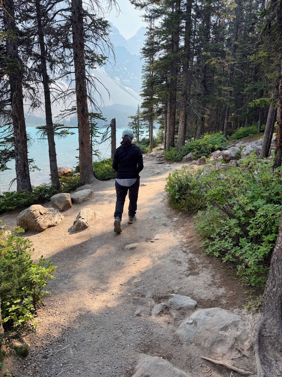
While we passed small cascades coming into the lake along the way, there is quite a large cascade at the far end flowing down into the lake.
On our hike back we paused on a bridge to take pictures of some of the glaciers hanging high above.
We caught an early-evening shuttle back to the ski area parking and returned to Banff.
On our last day in the area we first visited scenic Johnston Canyon. Hiking upstream, you pass several cascades before arriving at the main waterfall. The trail is sometimes just a steel walkway bolted to the cliffside.
We then drove over the nearby border to British Columbia (the western portion of Banff NP is close to the BC-Alberta border) and into Kootenay National Park to visit Marble Canyon, a canyon that narrows and deepens along its mile-long trail to the end where you can see the stream flowing down from the mountains.
We left Banff the next day and drove to a campground near Calgary for the last part of our Canadian adventure.
The Calgary Stampede
We'd heard about the Stampede in the past and had always wanted to go. During 12 days in July, the entire city turns into one huge celebration of cowboy culture. The default dress for many of the Calgarians (yes, that is what they call themselves) seems to be cowboy hats and boots, with the women wearing either Daisy Dukes or short dresses. Each day of the Stampede, there is a rodeo in the afternoon and a show in the evening. A few months in advance, we'd snagged tickets for the last 2 days of the stampede.
The campground we stayed at offered bus rides to and from the Stampede grounds about 25 minutes away, so we signed up. The driver, Miss Beth, would not allow us on the bus until we gave her a loud "Yahoo!" (NOTE: Not the Texas pronounciation of YeaHaw...). On the drive in, we passed by the site of some of the the 1988 Winter Olympics events.
In addition to the rodeo stadium, the Stampeded site had exhibit halls, food trucks, music performers, an area of amusement rides, and a midway with games.
On Saturday afternoon we attended the rodeo. The stands can seat over 20,000, and we witnessed bareback and saddle bronco busting, cattle roping, barrel racing, bull riding and other rodeo sports. We'd been to a couple of rodeos in the past, and the level of competition here was much higher than we'd seen before. Almost $2M Canadian in prize money is awarded over the course of the Stampede. In all the horse and bull events, we saw only one rider thrown before the eight-second horn went off. The rodeo lasted almost three hours.

We returned on Sunday, the Stampede's last day, for the evening show, which lasted for over four hours. Two more riding events were held. The first was chow-wagon racing (it held a special place in our RV hearts) which we understand originated at the Stampede over 100 years ago. There were eight rounds of three teams each. One cowboy is stationed at the head of the team of four, one sits in the driver's seat, and another stands behind the wagon. When the buzzer goes off, the rear cowboy lifts a campstove into the back of the wagon. The teams maneuver around barrels while the front and back cowboys leap onto their horses and they all head around the track at breakneck speeds. Times are added if any barrels are knocked over or the horse riders stray more than 200 feet behind their wagons. It was all quite exciting.
The other evening riding event (which we don't have pictures of, unfortunately) is the relay. All the teams were from area First Nations tribes. There are three horses for each team, and one rider serves as the baton, riding around the track on one horse, leaping off that one and onto the next horse (this is all done bareback without a bridle!) while two other team members stop the incoming horse and steady the next one to depart. A super exciting sport, and very popular with the crowd. During the final race, during the first lap, we watched on the jumbotron while two of the riders, who were racing neck and neck, looked at each other, smiled, and fist-bumped.
After the horse events were completed, a large stage was towed in front of the grandstand, and we were treated to performances by singers, acrobats, and a dance troupe of dozens of teen and elementary-aged kids called the Young Canadians who were phenomenal. They must empty out every dance school in Calgary and practice all year. They must also empty all store shelves in Calgary of sequins.

These were followed by a drone show (the first we'd ever seen live)...

...and fireworks.

After the performances were over and we were waiting outside for our bus, we ran into Brent and Pattie Bushman, two of the leaders from our 2025 Adventure Caravans trip down the Mississippi, who were now leading a group on their way to Alaska. Small world!
We highly recommend the Stampede if you ever get the chance to go.
We packed up the next morning and drove the Ciaowagen south and back over the U.S. border (with only a short wait) into Montana. More about that in our next blog post!


Comments